


Marseillveyre

Lobin
User
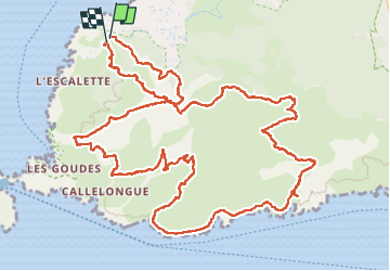

Length
17.9 km

Max alt
418 m

Uphill gradient
1342 m
Km-Effort
36 km

Min alt
3 m

Downhill gradient
1341 m
Boucle
Yes
Creation date :
2024-06-29 06:23:39.0
Updated on :
2024-06-29 17:53:17.194
9h32
Difficulty : Very difficult

FREE GPS app for hiking
 SityTrail
IGN / Geographical institutes
SityTrail Plus
The world is yours!
About
Trail Walking of 17.9 km to be discovered at Provence-Alpes-Côte d'Azur, Bouches-du-Rhône, Marseille. This trail is proposed by Lobin.
Description
Randonnée très difficile.
Si vous êtes sportif et vous aimer escalader, vous pouvez la tenter. Il ne faut non plus avoir peur du vide.
Bonne rando
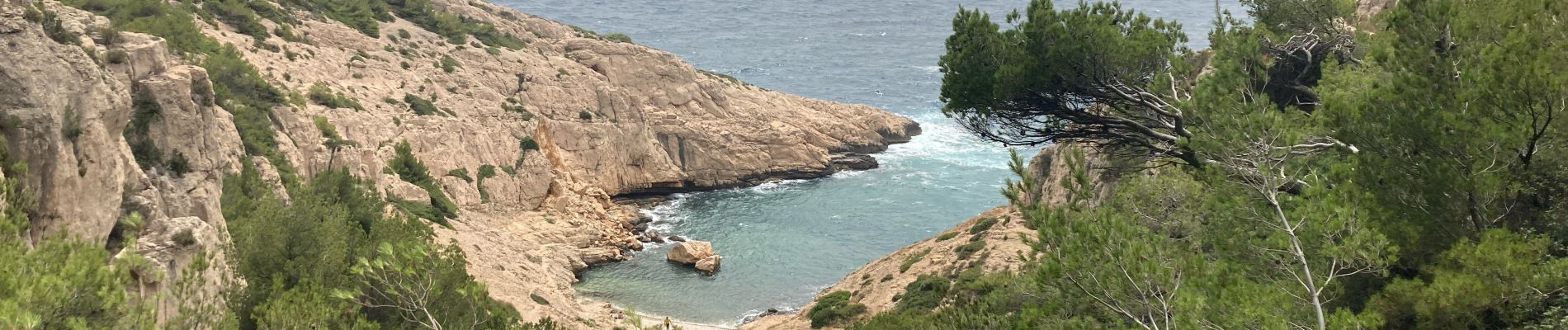
Photos


Positioning
Country:
France
Region :
Provence-Alpes-Côte d'Azur
Department/Province :
Bouches-du-Rhône
Municipality :
Marseille
Location:
8th Arrondissement
Start:(Dec)
Start:(UTM)
691228 ; 4789102 (31T) N.
Comments