


Serre-Chevalier - ND des Neiges - sommet du Prorel

cron
User
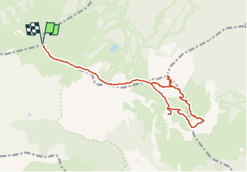

Length
9.7 km

Max alt
2546 m

Uphill gradient
580 m
Km-Effort
17.5 km

Min alt
2262 m

Downhill gradient
580 m
Boucle
Yes
Creation date :
2024-06-30 14:10:27.941
Updated on :
2024-06-30 14:11:30.871
3h58
Difficulty : Medium

FREE GPS app for hiking
 SityTrail
IGN / Geographical institutes
SityTrail Plus
The world is yours!
About
Trail Walking of 9.7 km to be discovered at Provence-Alpes-Côte d'Azur, Hautes-Alpes, Puy-Saint-André. This trail is proposed by cron.
Positioning
Country:
France
Region :
Provence-Alpes-Côte d'Azur
Department/Province :
Hautes-Alpes
Municipality :
Puy-Saint-André
Location:
Unknown
Start:(Dec)
Start:(UTM)
306596 ; 4975974 (32T) N.
Comments