


Praz sur arly ban rouge 1050m 18.7kms

Danielba
User GUIDE
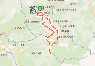

Length
17.4 km

Max alt
1977 m

Uphill gradient
1031 m
Km-Effort
31 km

Min alt
1005 m

Downhill gradient
1029 m
Boucle
Yes
Creation date :
2024-06-30 06:54:31.567
Updated on :
2024-06-30 15:50:44.353
8h40
Difficulty : Medium

FREE GPS app for hiking
 SityTrail
IGN / Geographical institutes
SityTrail Plus
The world is yours!
About
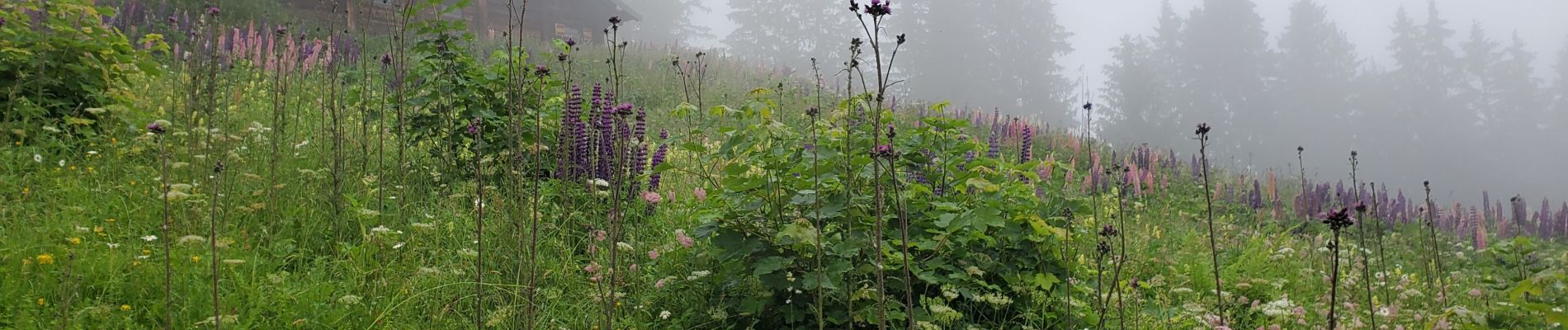
Trail Walking of 17.4 km to be discovered at Auvergne-Rhône-Alpes, Upper Savoy, Praz-sur-Arly. This trail is proposed by Danielba .
Photos


Positioning
Country:
France
Region :
Auvergne-Rhône-Alpes
Department/Province :
Upper Savoy
Municipality :
Praz-sur-Arly
Location:
Unknown
Start:(Dec)
Start:(UTM)
311054 ; 5078705 (32T) N.
Comments