


Circuit des deux Ruy

parastat
User

Length
7.9 km

Max alt
1074 m

Uphill gradient
356 m
Km-Effort
12.6 km

Min alt
725 m

Downhill gradient
351 m
Boucle
Yes
Creation date :
2024-07-02 09:42:57.49
Updated on :
2024-07-02 14:16:53.108
3h08
Difficulty : Difficult

FREE GPS app for hiking
 SityTrail
IGN / Geographical institutes
SityTrail Plus
The world is yours!
About
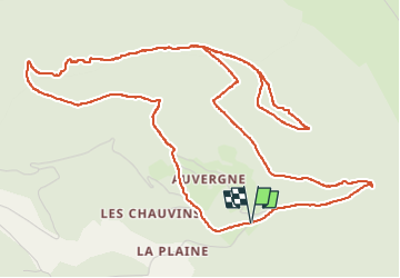
Trail Walking of 7.9 km to be discovered at Auvergne-Rhône-Alpes, Drôme, Vesc. This trail is proposed by parastat.
Positioning
Country:
France
Region :
Auvergne-Rhône-Alpes
Department/Province :
Drôme
Municipality :
Vesc
Location:
Unknown
Start:(Dec)
Start:(UTM)
671853 ; 4929505 (31T) N.
Comments