


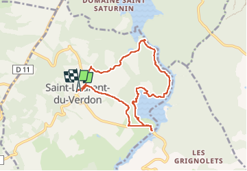
04 St Laure du Verdon

ericf64
User

Length
8.2 km

Max alt
477 m

Uphill gradient
158 m
Km-Effort
10.4 km

Min alt
402 m

Downhill gradient
161 m
Boucle
Yes
Creation date :
2024-06-18 07:19:02.714
Updated on :
2024-07-04 10:10:06.009
2h40
Difficulty : Medium

FREE GPS app for hiking
 SityTrail
IGN / Geographical institutes
SityTrail Plus
The world is yours!
About
Trail Walking of 8.2 km to be discovered at Provence-Alpes-Côte d'Azur, Alpes-de-Haute-Provence, Saint-Laurent-du-Verdon. This trail is proposed by ericf64.
Description
jolie boucle avec le joli village de St Laurent
Photos

Positioning
Country:
France
Region :
Provence-Alpes-Côte d'Azur
Department/Province :
Alpes-de-Haute-Provence
Municipality :
Saint-Laurent-du-Verdon
Location:
Unknown
Start:(Dec)
Start:(UTM)
263825 ; 4845481 (32T) N.
Comments