


2024-07-04 val saint germain Villeconin

Lucquiaud
User
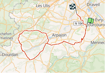

Length
83 km

Max alt
164 m

Uphill gradient
752 m
Km-Effort
93 km

Min alt
51 m

Downhill gradient
752 m
Boucle
No
Creation date :
2024-07-04 06:46:03.308
Updated on :
2024-07-04 10:53:11.67
4h06
Difficulty : Medium

FREE GPS app for hiking
 SityTrail
IGN / Geographical institutes
SityTrail Plus
The world is yours!
About
Trail Road bike of 83 km to be discovered at Ile-de-France, Essonne, Bondoufle. This trail is proposed by Lucquiaud.
Positioning
Country:
France
Region :
Ile-de-France
Department/Province :
Essonne
Municipality :
Bondoufle
Location:
Unknown
Start:(Dec)
Start:(UTM)
454086 ; 5384735 (31U) N.
Comments