


G2 articles lac de grezillard

LouisROGER
User GUIDE
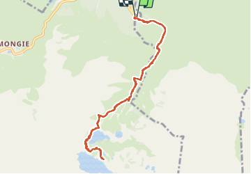

Length
10.4 km

Max alt
2147 m

Uphill gradient
737 m
Km-Effort
20 km

Min alt
1419 m

Downhill gradient
733 m
Boucle
Yes
Creation date :
2024-07-05 06:53:06.643
Updated on :
2024-07-06 06:02:42.64
7h18
Difficulty : Very difficult

FREE GPS app for hiking
 SityTrail
IGN / Geographical institutes
SityTrail Plus
The world is yours!
About
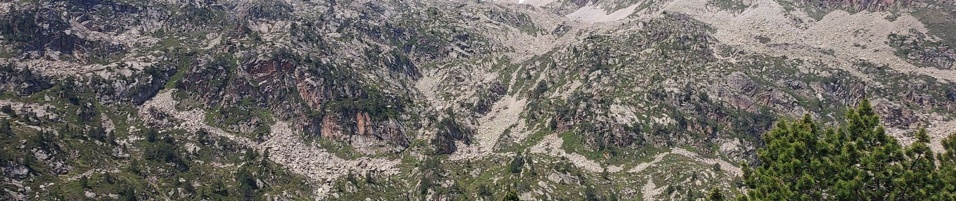
Trail Walking of 10.4 km to be discovered at Occitania, Hautespyrenees, Bagnères-de-Bigorre. This trail is proposed by LouisROGER.
Photos


Positioning
Country:
France
Region :
Occitania
Department/Province :
Hautespyrenees
Municipality :
Bagnères-de-Bigorre
Location:
Unknown
Start:(Dec)
Start:(UTM)
272261 ; 4755352 (31T) N.
Comments