


TOUR MONT LOZERE

asclier0
User
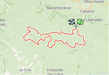

Length
38 km

Max alt
1609 m

Uphill gradient
639 m
Km-Effort
47 km

Min alt
1262 m

Downhill gradient
640 m
Boucle
Yes
Creation date :
2024-07-07 06:26:22.993
Updated on :
2024-07-07 18:15:24.675
3h14
Difficulty : Very difficult

FREE GPS app for hiking
 SityTrail
IGN / Geographical institutes
SityTrail Plus
The world is yours!
About
Trail Mountain bike of 38 km to be discovered at Occitania, Lozère, Cubières. This trail is proposed by asclier0.
Description
Boucle au départ de l'antenne au dessus de la station et retour par le col avec descente de la route.
Très roulant sans difficultés particulière.
2h30 en VTTAE
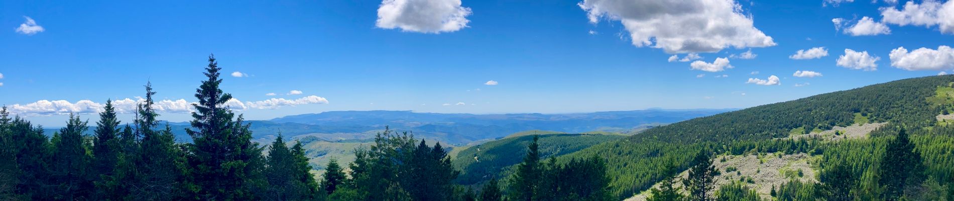
Photos


Positioning
Country:
France
Region :
Occitania
Department/Province :
Lozère
Municipality :
Cubières
Location:
Unknown
Start:(Dec)
Start:(UTM)
559530 ; 4921606 (31T) N.
Comments
Magnifique !