


Vallon de Corboeuf

Iahns
User

Length
4.4 km

Max alt
790 m

Uphill gradient
130 m
Km-Effort
6.2 km

Min alt
669 m

Downhill gradient
130 m
Boucle
Yes
Creation date :
2024-07-07 10:07:35.139
Updated on :
2024-07-07 13:27:04.855
3h18
Difficulty : Easy

FREE GPS app for hiking
 SityTrail
IGN / Geographical institutes
SityTrail Plus
The world is yours!
About
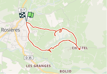
Trail Walking of 4.4 km to be discovered at Auvergne-Rhône-Alpes, Haute-Loire, Rosières. This trail is proposed by Iahns.
Positioning
Country:
France
Region :
Auvergne-Rhône-Alpes
Department/Province :
Haute-Loire
Municipality :
Rosières
Location:
Unknown
Start:(Dec)
Start:(UTM)
577975 ; 4998308 (31T) N.
Comments