


retour TOP 03

aldaus
User

Length
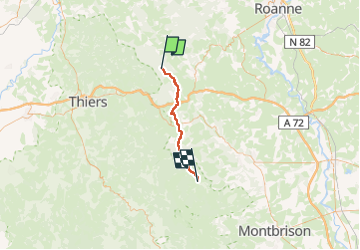
34 km

Max alt
1177 m

Uphill gradient
979 m
Km-Effort
47 km

Min alt
642 m

Downhill gradient
1094 m
Boucle
No
Creation date :
2024-07-10 04:39:22.131
Updated on :
2024-07-10 16:55:57.834
7h46
Difficulty : Medium

FREE GPS app for hiking
 SityTrail
IGN / Geographical institutes
SityTrail Plus
The world is yours!
About
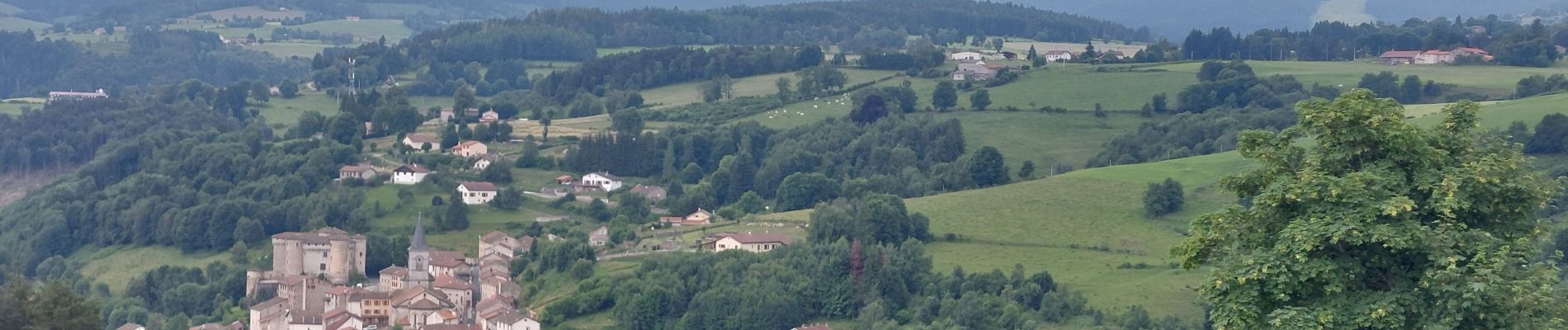
Trail Walking of 34 km to be discovered at Auvergne-Rhône-Alpes, Loire, Chausseterre. This trail is proposed by aldaus.
Photos


Positioning
Country:
France
Region :
Auvergne-Rhône-Alpes
Department/Province :
Loire
Municipality :
Chausseterre
Location:
Unknown
Start:(Dec)
Start:(UTM)
558300 ; 5085244 (31T) N.
Comments