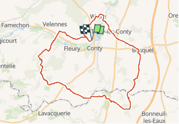
Autour de Conty

ORTAX
User

Length
38 km

Max alt
191 m

Uphill gradient
559 m
Km-Effort
45 km

Min alt
49 m

Downhill gradient
559 m
Boucle
Yes
Creation date :
2024-07-11 09:43:12.756
Updated on :
2024-07-11 09:43:50.259
3h08
Difficulty : Very difficult

FREE GPS app for hiking
 SityTrail
IGN / Geographical institutes
SityTrail Plus
The world is yours!
About
Trail Mountain bike of 38 km to be discovered at Hauts-de-France, Somme, Conty. This trail is proposed by ORTAX.
Positioning
Country:
France
Region :
Hauts-de-France
Department/Province :
Somme
Municipality :
Conty
Location:
Conty
Start:(Dec)
Start:(UTM)
438619 ; 5510931 (31U) N.
Comments