


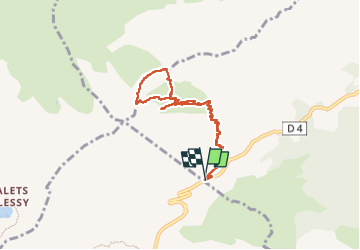
Lac de Peyre et pointe de Balafrasse

Clo0413
User

Length
7.8 km

Max alt
2278 m

Uphill gradient
668 m
Km-Effort
16.7 km

Min alt
1596 m

Downhill gradient
669 m
Boucle
Yes
Creation date :
2024-07-13 07:00:05.867
Updated on :
2024-07-13 16:14:46.761
3h47
Difficulty : Difficult

FREE GPS app for hiking
 SityTrail
IGN / Geographical institutes
SityTrail Plus
The world is yours!
About
Trail Walking of 7.8 km to be discovered at Auvergne-Rhône-Alpes, Upper Savoy, Le Reposoir. This trail is proposed by Clo0413.
Positioning
Country:
France
Region :
Auvergne-Rhône-Alpes
Department/Province :
Upper Savoy
Municipality :
Le Reposoir
Location:
Unknown
Start:(Dec)
Start:(UTM)
304388 ; 5096241 (32T) N.
Comments