


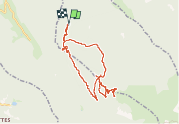
Refuge du Prė do Mollard en circuit partiel

Emelle
User

Length
11.1 km

Max alt
1737 m

Uphill gradient
622 m
Km-Effort
19.4 km

Min alt
1144 m

Downhill gradient
622 m
Boucle
Yes
Creation date :
2024-07-13 07:46:38.621
Updated on :
2024-07-13 13:02:00.642
3h36
Difficulty : Easy

FREE GPS app for hiking
 SityTrail
IGN / Geographical institutes
SityTrail Plus
The world is yours!
About
Trail Walking of 11.1 km to be discovered at Auvergne-Rhône-Alpes, Isère, Saint-Mury-Monteymond. This trail is proposed by Emelle.
Positioning
Country:
France
Region :
Auvergne-Rhône-Alpes
Department/Province :
Isère
Municipality :
Saint-Mury-Monteymond
Location:
Unknown
Start:(Dec)
Start:(UTM)
729296 ; 5010036 (31T) N.
Comments