


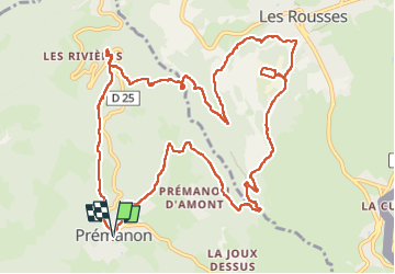
Prémanon Randonnée

daniellebou
User

Length
15.7 km

Max alt
1144 m

Uphill gradient
473 m
Km-Effort
22 km

Min alt
899 m

Downhill gradient
473 m
Boucle
Yes
Creation date :
2024-07-14 22:15:39.269
Updated on :
2024-07-14 22:47:49.62
5h00
Difficulty : Very difficult

FREE GPS app for hiking
 SityTrail
IGN / Geographical institutes
SityTrail Plus
The world is yours!
About
Trail Walking of 15.7 km to be discovered at Bourgogne-Franche-Comté, Jura. This trail is proposed by daniellebou.
Positioning
Country:
France
Region :
Bourgogne-Franche-Comté
Department/Province :
Jura
Municipality :
Unknown
Location:
Unknown
Start:(Dec)
Start:(UTM)
271998 ; 5149627 (32T) N.
Comments