


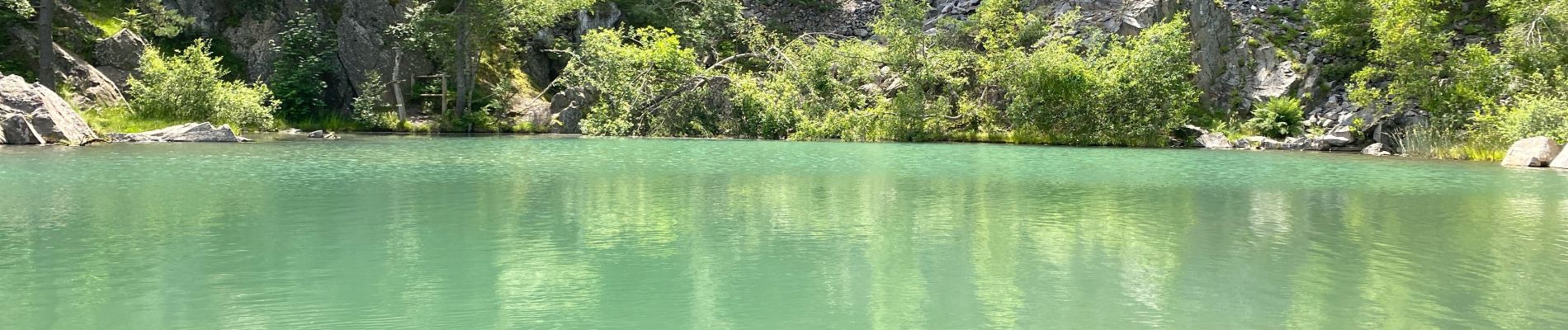
Lac bleue

Roger Philippe Wallez
User GUIDE
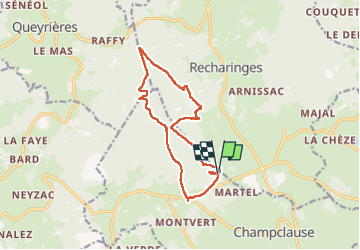

Length
14 km

Max alt
1426 m

Uphill gradient
419 m
Km-Effort
19.6 km

Min alt
1215 m

Downhill gradient
421 m
Boucle
Yes
Creation date :
2024-07-15 07:59:30.0
Updated on :
2024-07-15 13:34:54.599
5h34
Difficulty : Very difficult

FREE GPS app for hiking
 SityTrail
IGN / Geographical institutes
SityTrail Plus
The world is yours!
About
Trail Walking of 14 km to be discovered at Auvergne-Rhône-Alpes, Haute-Loire, Champclause. This trail is proposed by Roger Philippe Wallez.
Photos


Positioning
Country:
France
Region :
Auvergne-Rhône-Alpes
Department/Province :
Haute-Loire
Municipality :
Champclause
Location:
Unknown
Start:(Dec)
Start:(UTM)
591179 ; 4987692 (31T) N.
Comments