


Passo Duran - Rifugio Carestiato

i20
User
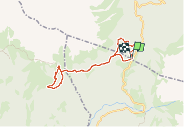

Length
7.6 km

Max alt
1829 m

Uphill gradient
360 m
Km-Effort
12.4 km

Min alt
1594 m

Downhill gradient
361 m
Boucle
Yes
Creation date :
2024-07-16 10:19:11.849
Updated on :
2024-07-17 06:39:41.644
2h05
Difficulty : Easy

FREE GPS app for hiking
 SityTrail
IGN / Geographical institutes
SityTrail Plus
The world is yours!
About
Trail Walking of 7.6 km to be discovered at Veneto, Belluno, Val di Zoldo. This trail is proposed by i20.
Positioning
Country:
Italy
Region :
Veneto
Department/Province :
Belluno
Municipality :
Val di Zoldo
Location:
Unknown
Start:(Dec)
Start:(UTM)
276463 ; 5134283 (33T) N.
Comments