


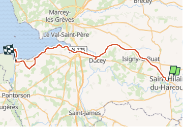
Véloscenie - Saint Hilaire le Mont

Sarah92130
User

Length
53 km

Max alt
115 m

Uphill gradient
415 m
Km-Effort
59 km

Min alt
0 m

Downhill gradient
473 m
Boucle
No
Creation date :
2024-07-16 08:03:53.897
Updated on :
2024-07-17 09:07:27.991
24h06
Difficulty : Very difficult

FREE GPS app for hiking
 SityTrail
IGN / Geographical institutes
SityTrail Plus
The world is yours!
About
Trail Bicycle tourism of 53 km to be discovered at Normandy, Manche, Saint-Hilaire-du-Harcouët. This trail is proposed by Sarah92130.
Positioning
Country:
France
Region :
Normandy
Department/Province :
Manche
Municipality :
Saint-Hilaire-du-Harcouët
Location:
Saint-Hilaire-du-Harcouët
Start:(Dec)
Start:(UTM)
640273 ; 5382360 (30U) N.
Comments