


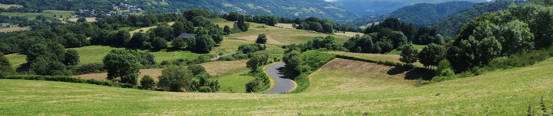
la bourboule, sommet de l'ancien téléphérique

francislassauce
User
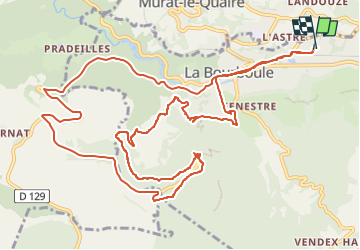

Length
16.2 km

Max alt
1202 m

Uphill gradient
444 m
Km-Effort
22 km

Min alt
847 m

Downhill gradient
443 m
Boucle
Yes
Creation date :
2024-07-17 09:07:22.069
Updated on :
2024-07-17 11:26:55.254
2h18
Difficulty : Medium

FREE GPS app for hiking
 SityTrail
IGN / Geographical institutes
SityTrail Plus
The world is yours!
About
Trail Mountain bike of 16.2 km to be discovered at Auvergne-Rhône-Alpes, Puy-de-Dôme, La Bourboule. This trail is proposed by francislassauce.
Photos


Positioning
Country:
France
Region :
Auvergne-Rhône-Alpes
Department/Province :
Puy-de-Dôme
Municipality :
La Bourboule
Location:
Unknown
Start:(Dec)
Start:(UTM)
480856 ; 5048738 (31T) N.
Comments