


Chalam 17/07/24

th&jm
User
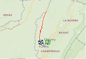

Length
10.6 km

Max alt
1524 m

Uphill gradient
934 m
Km-Effort
23 km

Min alt
600 m

Downhill gradient
933 m
Boucle
Yes
Creation date :
2024-07-17 07:59:12.0
Updated on :
2024-07-17 13:01:14.972

FREE GPS app for hiking
 SityTrail
IGN / Geographical institutes
SityTrail Plus
The world is yours!
About
Trail of 10.6 km to be discovered at Auvergne-Rhône-Alpes, Ain, Chézery-Forens. This trail is proposed by th&jm.
Positioning
Country:
France
Region :
Auvergne-Rhône-Alpes
Department/Province :
Ain
Municipality :
Chézery-Forens
Location:
Unknown
Start:(Dec)
Start:(UTM)
720484 ; 5121805 (31T) N.
Comments