


Esch-sur-Sûre (PVDB)

Peter.vdbergh
User GUIDE
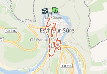

Length
1.9 km

Max alt
314 m

Uphill gradient
50 m
Km-Effort
2.6 km

Min alt
277 m

Downhill gradient
49 m
Boucle
Yes
Creation date :
2024-07-17 12:28:49.808
Updated on :
2024-07-23 19:03:01.839
35m
Difficulty : Easy

FREE GPS app for hiking
 SityTrail
IGN / Geographical institutes
SityTrail Plus
The world is yours!
About
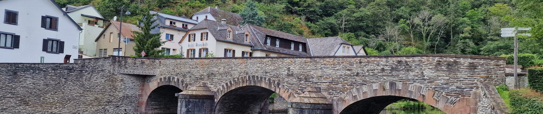
Trail Walking of 1.9 km to be discovered at Unknown, Canton Wiltz, Esch-sur-Sûre. This trail is proposed by Peter.vdbergh.
Photos
 - Photo 1")
 - Photo 2")
 - Photo 3")
 - Photo 4")
 - Photo 5")
 - Photo 6")
 - Photo 7")
 - Photo 8")
 - Photo 9")
 - Photo 10")
Positioning
Country:
Luxembourg
Region :
Unknown
Department/Province :
Canton Wiltz
Municipality :
Esch-sur-Sûre
Location:
Unknown
Start:(Dec)
Start:(UTM)
710657 ; 5533036 (31U) N.
Comments