


les Aldieres- Bacheluze

Jean Yves Erard
User
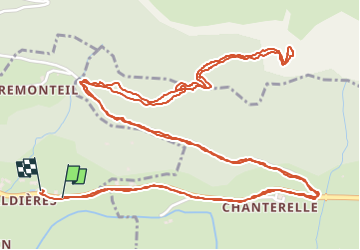

Length
5.8 km

Max alt
889 m

Uphill gradient
293 m
Km-Effort
9.7 km

Min alt
583 m

Downhill gradient
290 m
Boucle
Yes
Creation date :
2024-07-18 09:05:05.923
Updated on :
2024-07-18 11:16:05.723
2h09
Difficulty : Medium

FREE GPS app for hiking
 SityTrail
IGN / Geographical institutes
SityTrail Plus
The world is yours!
About
Trail Walking of 5.8 km to be discovered at Auvergne-Rhône-Alpes, Cantal, Anglards-de-Salers. This trail is proposed by Jean Yves Erard.
Description
montée d entraînement
Positioning
Country:
France
Region :
Auvergne-Rhône-Alpes
Department/Province :
Cantal
Municipality :
Anglards-de-Salers
Location:
Unknown
Start:(Dec)
Start:(UTM)
459568 ; 5006960 (31T) N.
Comments