


Bois du Casier2

jackcox
User
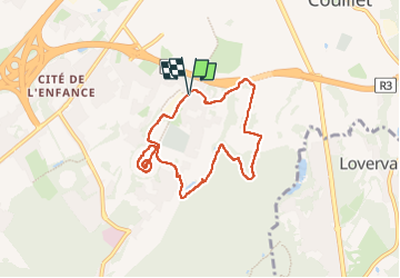

Length
6.6 km

Max alt
226 m

Uphill gradient
158 m
Km-Effort
8.7 km

Min alt
122 m

Downhill gradient
160 m
Boucle
Yes
Creation date :
2024-07-15 06:26:05.843
Updated on :
2024-07-18 16:57:31.039
1h44
Difficulty : Medium

FREE GPS app for hiking
 SityTrail
IGN / Geographical institutes
SityTrail Plus
The world is yours!
About
Trail Walking of 6.6 km to be discovered at Wallonia, Hainaut, Charleroi. This trail is proposed by jackcox.
Description
marche Jacques
Positioning
Country:
Belgium
Region :
Wallonia
Department/Province :
Hainaut
Municipality :
Charleroi
Location:
Unknown
Start:(Dec)
Start:(UTM)
602764 ; 5582078 (31U) N.
Comments