


Circuit roche tocquaine

Emmanuel Remy
User
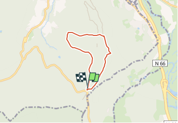

Length
4.7 km

Max alt
712 m

Uphill gradient
140 m
Km-Effort
6.5 km

Min alt
632 m

Downhill gradient
133 m
Boucle
Yes
Creation date :
2024-07-22 12:17:32.883
Updated on :
2024-07-22 12:18:00.623
1h28
Difficulty : Easy

FREE GPS app for hiking
 SityTrail
IGN / Geographical institutes
SityTrail Plus
The world is yours!
About
Trail On foot of 4.7 km to be discovered at Grand Est, Vosges, Remiremont. This trail is proposed by Emmanuel Remy.
Positioning
Country:
France
Region :
Grand Est
Department/Province :
Vosges
Municipality :
Remiremont
Location:
Unknown
Start:(Dec)
Start:(UTM)
320518 ; 5317664 (32T) N.
Comments