


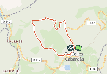
Roc de Nouret à Pradelles Cabardès

SoleilMoussanais
User

Length
7.8 km

Max alt
1068 m

Uphill gradient
296 m
Km-Effort
11.7 km

Min alt
832 m

Downhill gradient
296 m
Boucle
Yes
Creation date :
2024-07-22 17:43:38.677
Updated on :
2024-07-22 17:48:00.785
3h00
Difficulty : Medium

FREE GPS app for hiking
 SityTrail
IGN / Geographical institutes
SityTrail Plus
The world is yours!
About
Trail On foot of 7.8 km to be discovered at Occitania, Aude, Pradelles-Cabardès. This trail is proposed by SoleilMoussanais.
Description
A proximité du Pic de Nore, à la découverte du Roc Nouret, de la Cabane d'Hélène, de la source des Bayours, et des anciennes glacières.
Positioning
Country:
France
Region :
Occitania
Department/Province :
Aude
Municipality :
Pradelles-Cabardès
Location:
Unknown
Start:(Dec)
Start:(UTM)
455128 ; 4806321 (31T) N.
Comments