


23_07_24

baudon
User
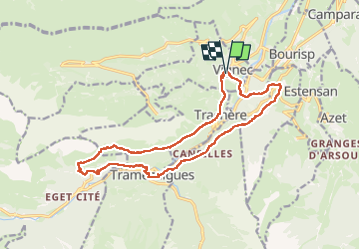

Length
19 km

Max alt
1422 m

Uphill gradient
818 m
Km-Effort
30 km

Min alt
810 m

Downhill gradient
821 m
Boucle
Yes
Creation date :
2024-07-23 06:46:15.759
Updated on :
2024-07-23 16:00:19.731
9h10
Difficulty : Very difficult

FREE GPS app for hiking
 SityTrail
IGN / Geographical institutes
SityTrail Plus
The world is yours!
About
Trail Walking of 19 km to be discovered at Occitania, Hautespyrenees, Vignec. This trail is proposed by baudon.
Positioning
Country:
France
Region :
Occitania
Department/Province :
Hautespyrenees
Municipality :
Vignec
Location:
Unknown
Start:(Dec)
Start:(UTM)
280547 ; 4744680 (31T) N.
Comments