


Loule Lac Supérieur Lac du Bastanet Loule

JMFr
User

Length
20 km

Max alt
2322 m

Uphill gradient
931 m
Km-Effort
32 km

Min alt
1601 m

Downhill gradient
932 m
Boucle
Yes
Creation date :
2024-07-24 06:30:16.411
Updated on :
2024-07-25 13:30:21.401
4h24
Difficulty : Difficult

FREE GPS app for hiking
 SityTrail
IGN / Geographical institutes
SityTrail Plus
The world is yours!
About
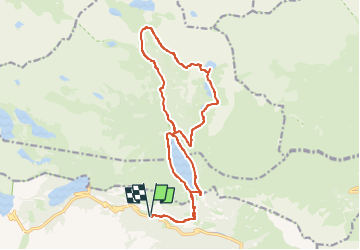
Trail Walking of 20 km to be discovered at Occitania, Hautespyrenees, Aragnouet. This trail is proposed by JMFr.
Description
Attention, boucle à faire dans le sens indiqué sur l'enregistrement. A mon avis !
Positioning
Country:
France
Region :
Occitania
Department/Province :
Hautespyrenees
Municipality :
Aragnouet
Location:
Unknown
Start:(Dec)
Start:(UTM)
270300 ; 4744565 (31T) N.
Comments