


Le Trou du Loup(17K 520D+)

kayamb
User
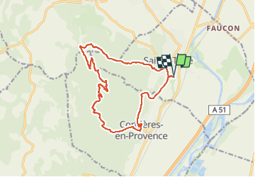

Length
16.6 km

Max alt
486 m

Uphill gradient
521 m
Km-Effort
24 km

Min alt
279 m

Downhill gradient
522 m
Boucle
Yes
Creation date :
2024-07-26 04:21:16.0
Updated on :
2024-07-26 06:45:40.553
2h17
Difficulty : Medium

FREE GPS app for hiking
 SityTrail
IGN / Geographical institutes
SityTrail Plus
The world is yours!
About
Trail Trail of 16.6 km to be discovered at Provence-Alpes-Côte d'Azur, Alpes-de-Haute-Provence, Sainte-Tulle. This trail is proposed by kayamb.
Photos
 - Photo 1")
 - Photo 2")
 - Photo 3")
 - Photo 4")
Positioning
Country:
France
Region :
Provence-Alpes-Côte d'Azur
Department/Province :
Alpes-de-Haute-Provence
Municipality :
Sainte-Tulle
Location:
Unknown
Start:(Dec)
Start:(UTM)
722553 ; 4851147 (31T) N.
Comments