


2024-04-16_Sucettes de Borne

Christiancordin
User
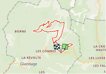

Length
18.7 km

Max alt
1611 m

Uphill gradient
972 m
Km-Effort
32 km

Min alt
1105 m

Downhill gradient
964 m
Boucle
Yes
Creation date :
2024-07-26 16:34:06.519
Updated on :
2024-07-26 16:48:55.58
7h11
Difficulty : Difficult

FREE GPS app for hiking
 SityTrail
IGN / Geographical institutes
SityTrail Plus
The world is yours!
About
Trail On foot of 18.7 km to be discovered at Auvergne-Rhône-Alpes, Drôme, Glandage. This trail is proposed by Christiancordin.
Description
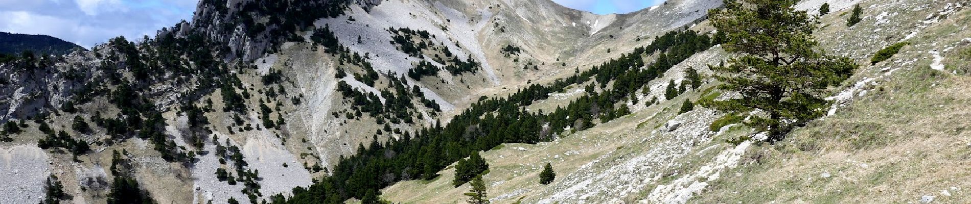
D Grimone (gîte), la Pouyat, GR 93, ravin de Clastre, col de la Peyère, Côte Pleine, les sucettes de Borne, col Lachau 1484m, la Grande Plâte, ravin de Clastre, Grimone.
Photos


Positioning
Country:
France
Region :
Auvergne-Rhône-Alpes
Department/Province :
Drôme
Municipality :
Glandage
Location:
Unknown
Start:(Dec)
Start:(UTM)
708799 ; 4952572 (31T) N.
Comments