


Loge supeyres 24k

ophness
User
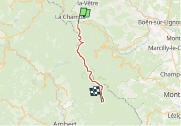

Length
23 km

Max alt
1609 m

Uphill gradient
629 m
Km-Effort
31 km

Min alt
1251 m

Downhill gradient
516 m
Boucle
No
Creation date :
2024-07-27 06:57:32.0
Updated on :
2024-07-27 06:57:33.864

FREE GPS app for hiking
 SityTrail
IGN / Geographical institutes
SityTrail Plus
The world is yours!
About
Trail of 23 km to be discovered at Auvergne-Rhône-Alpes, Loire, Chalmazel-Jeansagnière. This trail is proposed by ophness.
Positioning
Country:
France
Region :
Auvergne-Rhône-Alpes
Department/Province :
Loire
Municipality :
Chalmazel-Jeansagnière
Location:
Jeansagnière
Start:(Dec)
Start:(UTM)
560658 ; 5065709 (31T) N.
Comments