


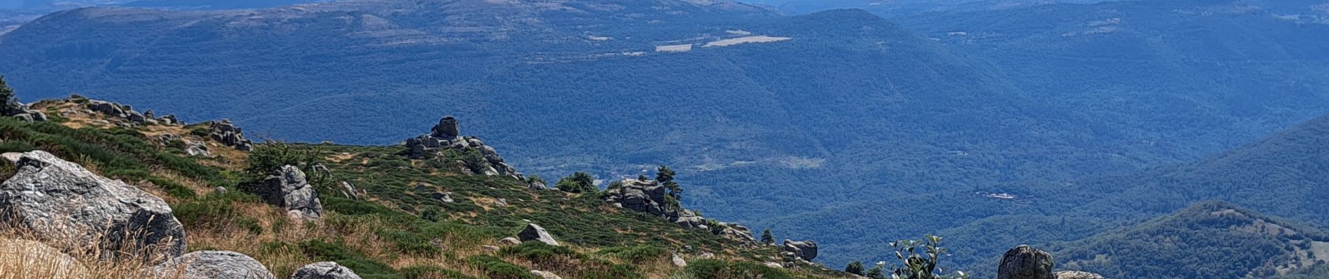
Lac de Pises au départ Le Travers

nadinebondoux
User GUIDE
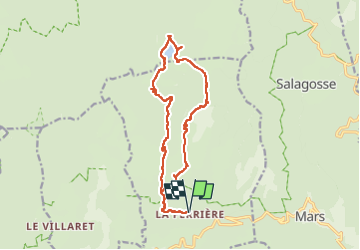

Length
16.7 km

Max alt
1335 m

Uphill gradient
754 m
Km-Effort
27 km

Min alt
711 m

Downhill gradient
754 m
Boucle
Yes
Creation date :
2024-07-27 07:36:39.088
Updated on :
2024-07-27 14:51:56.98
7h13
Difficulty : Difficult

FREE GPS app for hiking
 SityTrail
IGN / Geographical institutes
SityTrail Plus
The world is yours!
About
Trail Walking of 16.7 km to be discovered at Occitania, Gard, Aumessas. This trail is proposed by nadinebondoux.
Photos


21 photos in total. Please click on a photo to see them all in the gallery.
Positioning
Country:
France
Region :
Occitania
Department/Province :
Gard
Municipality :
Aumessas
Location:
Unknown
Start:(Dec)
Start:(UTM)
541253 ; 4872228 (31T) N.
Comments