


Theneuil - la Samsonnière Lièze AM - 16.6km 275m 3h40 (1h05) - 2024 07 28

Orcal37
User GUIDE
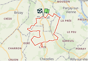

Length
16.6 km

Max alt
110 m

Uphill gradient
276 m
Km-Effort
20 km

Min alt
37 m

Downhill gradient
277 m
Boucle
Yes
Creation date :
2024-07-28 08:28:01.314
Updated on :
2024-07-29 20:37:46.101
3h40
Difficulty : Easy

FREE GPS app for hiking
 SityTrail
IGN / Geographical institutes
SityTrail Plus
The world is yours!
About
Trail Walking of 16.6 km to be discovered at Centre-Loire Valley, Indre-et-Loire, Theneuil. This trail is proposed by Orcal37.
Description
Theneuil - PR jusqu'à la Samsonnière - Lièze - 16.6km 275m 3h40 (1h05) - 2024 07 28
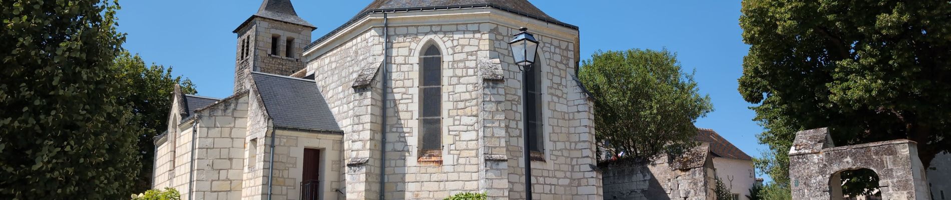
Photos
 - 2024 07 28 - Photo 1")
 - 2024 07 28 - Photo 2")
 - 2024 07 28 - Photo 3")
 - 2024 07 28 - Photo 4")
 - 2024 07 28 - Photo 5")
 - 2024 07 28 - Photo 6")
 - 2024 07 28 - Photo 7")
 - 2024 07 28 - Photo 8")
 - 2024 07 28 - Photo 9")
 - 2024 07 28 - Photo 10")
Positioning
Country:
France
Region :
Centre-Loire Valley
Department/Province :
Indre-et-Loire
Municipality :
Theneuil
Location:
Unknown
Start:(Dec)
Start:(UTM)
305640 ; 5219204 (31T) N.
Comments