


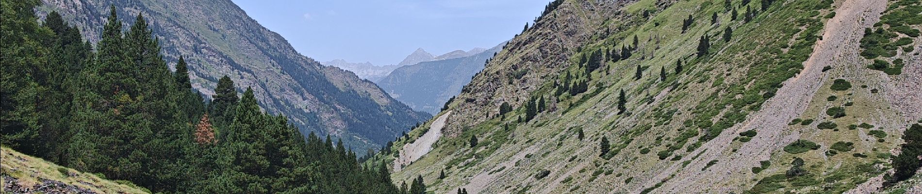
Granges de moudang et source ferrugineuse

fbienmuller
User
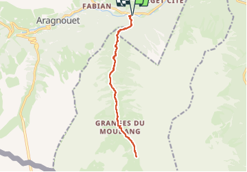

Length
15.3 km

Max alt
1696 m

Uphill gradient
729 m
Km-Effort
25 km

Min alt
1058 m

Downhill gradient
730 m
Boucle
Yes
Creation date :
2024-07-29 07:34:37.307
Updated on :
2024-07-29 14:08:31.861
4h47
Difficulty : Easy

FREE GPS app for hiking
 SityTrail
IGN / Geographical institutes
SityTrail Plus
The world is yours!
About
Trail Walking of 15.3 km to be discovered at Occitania, Hautespyrenees, Aragnouet. This trail is proposed by fbienmuller.
Photos


Positioning
Country:
France
Region :
Occitania
Department/Province :
Hautespyrenees
Municipality :
Aragnouet
Location:
Unknown
Start:(Dec)
Start:(UTM)
274789 ; 4740779 (31T) N.
Comments