


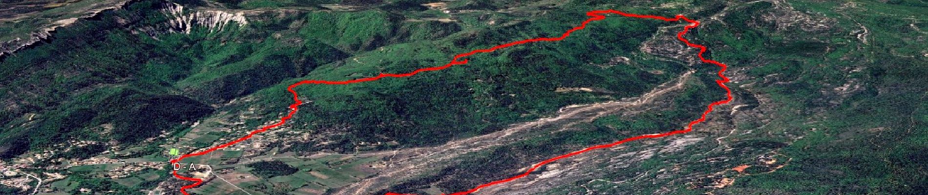
NSB5-MazauguesPivautI-220424

affinetataille
User GUIDE
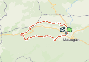

Length
16 km

Max alt
698 m

Uphill gradient
396 m
Km-Effort
21 km

Min alt
368 m

Downhill gradient
395 m
Boucle
Yes
Creation date :
2024-07-29 17:13:56.206
Updated on :
2025-03-14 19:48:22.542
6h00
Difficulty : Medium

FREE GPS app for hiking
 SityTrail
IGN / Geographical institutes
SityTrail Plus
The world is yours!
About
Trail Walking of 16 km to be discovered at Provence-Alpes-Côte d'Azur, Var, Mazaugues. This trail is proposed by affinetataille.
Description
grp_trc:
Photos


37 photos in total. Please click on a photo to see them all in the gallery.
Positioning
Country:
France
Region :
Provence-Alpes-Côte d'Azur
Department/Province :
Var
Municipality :
Mazaugues
Location:
Unknown
Start:(Dec)
Start:(UTM)
736171 ; 4803997 (31T) N.
Comments