


Pica d'Estats et Montcalm

ARVIEU
User

Length
18.8 km

Max alt
3095 m

Uphill gradient
2018 m
Km-Effort
46 km

Min alt
1182 m

Downhill gradient
2019 m
Boucle
Yes
Creation date :
2024-07-30 14:20:52.428
Updated on :
2024-07-30 14:27:33.624
10h23
Difficulty : Very difficult

FREE GPS app for hiking
 SityTrail
IGN / Geographical institutes
SityTrail Plus
The world is yours!
About
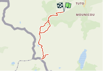
Trail Walking of 18.8 km to be discovered at Occitania, Ariège, Auzat. This trail is proposed by ARVIEU.
Description
Départ du parking de l'Artigue, montée au refuge du Pinet pour la nuit, le lendemain les sommets Pica d'Estats et Montcalm, retour à l'Artigue ou passer la nuit au refuge du Pinet
Photos


Positioning
Country:
France
Region :
Occitania
Department/Province :
Ariège
Municipality :
Auzat
Location:
Unknown
Start:(Dec)
Start:(UTM)
370994 ; 4729846 (31T) N.
Comments