


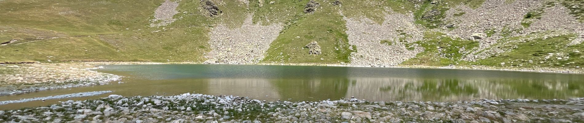
Lac de Millefonds (le premier)

jwo47
User
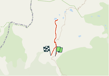

Length
4.1 km

Max alt
2236 m

Uphill gradient
211 m
Km-Effort
6.9 km

Min alt
2028 m

Downhill gradient
211 m
Boucle
Yes
Creation date :
2024-07-31 08:20:59.0
Updated on :
2024-07-31 12:01:38.087

FREE GPS app for hiking
 SityTrail
IGN / Geographical institutes
SityTrail Plus
The world is yours!
About
Trail of 4.1 km to be discovered at Provence-Alpes-Côte d'Azur, Maritime Alps, Valdeblore. This trail is proposed by jwo47.
Description
Pour la famille par contre assez de petits et gros cailloux. De bonnes chaussures.
Photos
 - Photo 1")
Positioning
Country:
France
Region :
Provence-Alpes-Côte d'Azur
Department/Province :
Maritime Alps
Municipality :
Valdeblore
Location:
Unknown
Start:(Dec)
Start:(UTM)
355013 ; 4884360 (32T) N.
Comments