


19279492

topolino
User
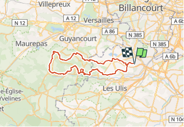

Length
54 km

Max alt
177 m

Uphill gradient
780 m
Km-Effort
64 km

Min alt
78 m

Downhill gradient
781 m
Boucle
Yes
Creation date :
2024-08-01 08:01:45.0
Updated on :
2024-08-01 08:01:50.299

FREE GPS app for hiking
 SityTrail
IGN / Geographical institutes
SityTrail Plus
The world is yours!
About
Trail of 54 km to be discovered at Ile-de-France, Essonne, Igny. This trail is proposed by topolino.
Positioning
Country:
France
Region :
Ile-de-France
Department/Province :
Essonne
Municipality :
Igny
Location:
Unknown
Start:(Dec)
Start:(UTM)
442835 ; 5397198 (31U) N.
Comments