


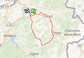
SAINT PIERRE COL DES ARAVIS PAR FLUMET

leclaude74
User

Length
106 km

Max alt
1488 m

Uphill gradient
1959 m
Km-Effort
132 km

Min alt
446 m

Downhill gradient
1959 m
Boucle
Yes
Creation date :
2024-08-02 19:33:42.991
Updated on :
2024-08-02 19:42:41.785
0m
Difficulty : Difficult

FREE GPS app for hiking
 SityTrail
IGN / Geographical institutes
SityTrail Plus
The world is yours!
About
Trail Cycle of 106 km to be discovered at Auvergne-Rhône-Alpes, Upper Savoy, Saint-Pierre-en-Faucigny. This trail is proposed by leclaude74.
Positioning
Country:
France
Region :
Auvergne-Rhône-Alpes
Department/Province :
Upper Savoy
Municipality :
Saint-Pierre-en-Faucigny
Location:
Unknown
Start:(Dec)
Start:(UTM)
296993 ; 5104019 (32T) N.
Comments