


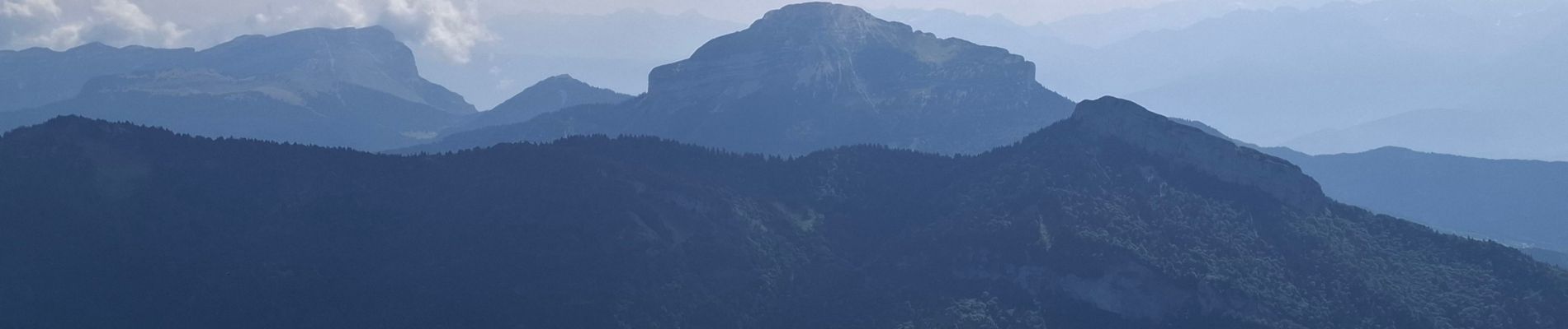
rochers de Chalves d’après Geba

bymarc26
User
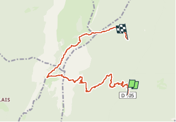

Length
9.5 km

Max alt
1840 m

Uphill gradient
968 m
Km-Effort
21 km

Min alt
907 m

Downhill gradient
557 m
Boucle
No
Creation date :
2024-08-01 06:22:14.905
Updated on :
2024-08-04 06:16:41.879
3h21
Difficulty : Difficult

FREE GPS app for hiking
 SityTrail
IGN / Geographical institutes
SityTrail Plus
The world is yours!
About
Trail Walking of 9.5 km to be discovered at Auvergne-Rhône-Alpes, Isère, Proveysieux. This trail is proposed by bymarc26.
Description
le GPS s'est arrêté à 2.5km env de l'arrivée.
Photos


Positioning
Country:
France
Region :
Auvergne-Rhône-Alpes
Department/Province :
Isère
Municipality :
Proveysieux
Location:
Unknown
Start:(Dec)
Start:(UTM)
713342 ; 5019174 (31T) N.
Comments