


Boucle 15km memenil

bohynm
User
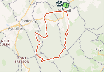

Length
15.8 km

Max alt
556 m

Uphill gradient
296 m
Km-Effort
19.7 km

Min alt
353 m

Downhill gradient
290 m
Boucle
Yes
Creation date :
2024-08-04 08:21:55.0
Updated on :
2024-08-04 12:24:02.764

FREE GPS app for hiking
 SityTrail
IGN / Geographical institutes
SityTrail Plus
The world is yours!
About
Trail of 15.8 km to be discovered at Grand Est, Vosges, Viménil. This trail is proposed by bohynm.
Positioning
Country:
France
Region :
Grand Est
Department/Province :
Vosges
Municipality :
Viménil
Location:
Unknown
Start:(Dec)
Start:(UTM)
324072 ; 5344095 (32U) N.
Comments