


GR_34_DB_23_Ploubazlanec_Lezardrieux_20240804

patrickdanilo
User
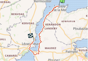

Length
10.5 km

Max alt
40 m

Uphill gradient
220 m
Km-Effort
13.5 km

Min alt
0 m

Downhill gradient
219 m
Boucle
No
Creation date :
2024-08-04 07:41:56.048
Updated on :
2024-08-16 15:06:27.548
2h45
Difficulty : Medium

FREE GPS app for hiking
 SityTrail
IGN / Geographical institutes
SityTrail Plus
The world is yours!
About
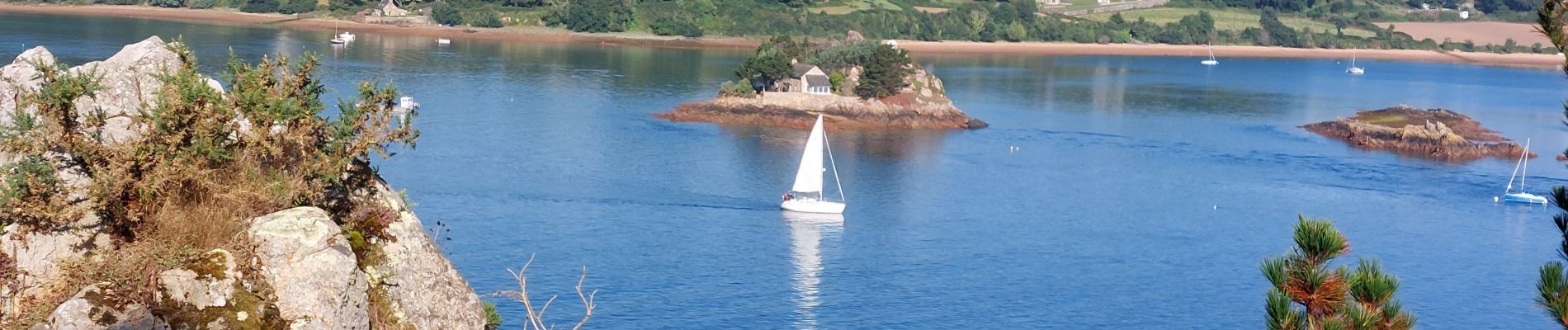
Trail Walking of 10.5 km to be discovered at Brittany, Côtes-d'Armor, Ploubazlanec. This trail is proposed by patrickdanilo.
Description
Randonnée Marche de 10,5 km à découvrir à Bretagne, Côtes-d'Armor, Ploubazlanec. Cette randonnée est proposée par patrickdanilo.
Photos


Positioning
Country:
France
Region :
Brittany
Department/Province :
Côtes-d'Armor
Municipality :
Ploubazlanec
Location:
Unknown
Start:(Dec)
Start:(UTM)
495145 ; 5407627 (30U) N.
Comments