


Trêves via Dourbies

Roger Philippe Wallez
User GUIDE
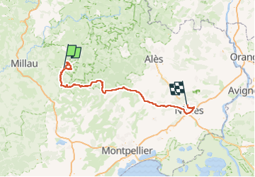

Length
163 km

Max alt
1290 m

Uphill gradient
3012 m
Km-Effort
205 km

Min alt
31 m

Downhill gradient
3429 m
Boucle
No
Creation date :
2024-08-03 15:00:06.0
Updated on :
2024-08-04 17:33:15.706
10h06
Difficulty : Very difficult

FREE GPS app for hiking
 SityTrail
IGN / Geographical institutes
SityTrail Plus
The world is yours!
About
Trail Walking of 163 km to be discovered at Occitania, Gard, Trèves. This trail is proposed by Roger Philippe Wallez.
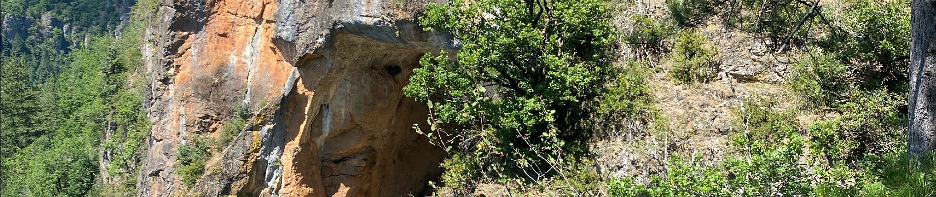
Photos


Positioning
Country:
France
Region :
Occitania
Department/Province :
Gard
Municipality :
Trèves
Location:
Unknown
Start:(Dec)
Start:(UTM)
531151 ; 4880482 (31T) N.
Comments