


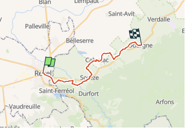
Etape 2 - Revel Dourgne

Alain28/01
User

Length
17.3 km

Max alt
285 m

Uphill gradient
231 m
Km-Effort
20 km

Min alt
216 m

Downhill gradient
181 m
Boucle
No
Creation date :
2024-08-06 15:11:13.487
Updated on :
2024-08-06 15:12:16.894
4h35
Difficulty : Medium

FREE GPS app for hiking
 SityTrail
IGN / Geographical institutes
SityTrail Plus
The world is yours!
About
Trail Walking of 17.3 km to be discovered at Occitania, Haute-Garonne, Revel. This trail is proposed by Alain28/01.
Positioning
Country:
France
Region :
Occitania
Department/Province :
Haute-Garonne
Municipality :
Revel
Location:
Unknown
Start:(Dec)
Start:(UTM)
419556 ; 4812146 (31T) N.
Comments