


SityTrail - rocbaron victor

affinetataille
User GUIDE

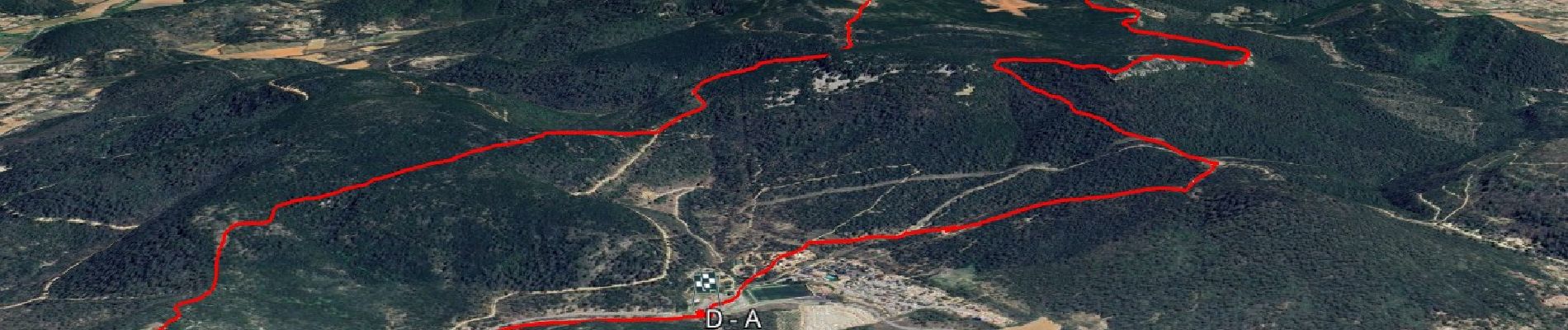
Length
14.2 km

Max alt
584 m

Uphill gradient
472 m
Km-Effort
21 km

Min alt
345 m

Downhill gradient
472 m
Boucle
Yes
Creation date :
2024-08-06 16:41:25.411
Updated on :
2025-01-17 17:40:37.1
6h00
Difficulty : Medium

FREE GPS app for hiking
 SityTrail
IGN / Geographical institutes
SityTrail Plus
The world is yours!
About
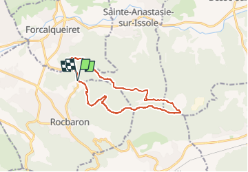
Trail Walking of 14.2 km to be discovered at Provence-Alpes-Côte d'Azur, Var, Rocbaron. This trail is proposed by affinetataille.
Photos


Positioning
Country:
France
Region :
Provence-Alpes-Côte d'Azur
Department/Province :
Var
Municipality :
Rocbaron
Location:
Unknown
Start:(Dec)
Start:(UTM)
264450 ; 4800333 (32T) N.
Comments