


col de la loge

josy31
User
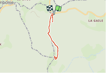

Length
6 km

Max alt
1384 m

Uphill gradient
166 m
Km-Effort
8.2 km

Min alt
1250 m

Downhill gradient
163 m
Boucle
Yes
Creation date :
2024-08-06 07:58:47.263
Updated on :
2024-08-06 18:07:26.161
2h04
Difficulty : Easy

FREE GPS app for hiking
 SityTrail
IGN / Geographical institutes
SityTrail Plus
The world is yours!
About
Trail Walking of 6 km to be discovered at Auvergne-Rhône-Alpes, Loire, Chalmazel-Jeansagnière. This trail is proposed by josy31.
Description
Belle balade ombragée. Le top : une biche au sommet !
Positioning
Country:
France
Region :
Auvergne-Rhône-Alpes
Department/Province :
Loire
Municipality :
Chalmazel-Jeansagnière
Location:
Jeansagnière
Start:(Dec)
Start:(UTM)
560742 ; 5065690 (31T) N.
Comments