


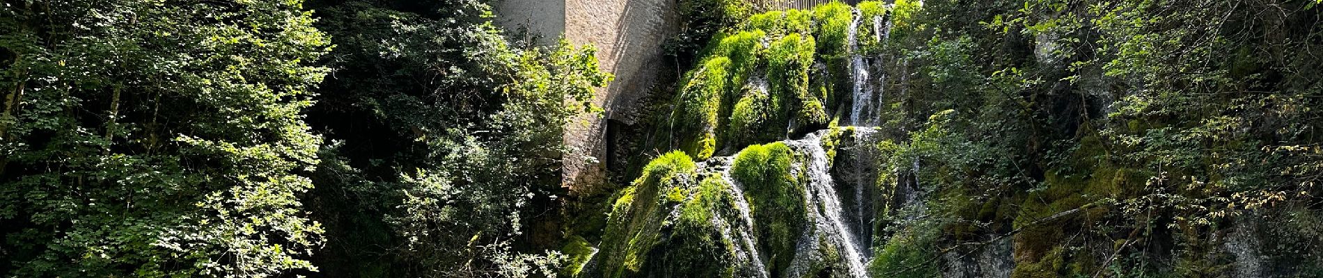
La source bleue et sa grande cascade à Montperreux

Benjamin27
User GUIDE
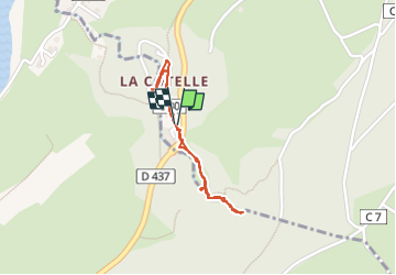

Length
1.4 km

Max alt
931 m

Uphill gradient
52 m
Km-Effort
2.1 km

Min alt
870 m

Downhill gradient
50 m
Boucle
Yes
Creation date :
2024-08-08 11:08:32.0
Updated on :
2024-08-11 18:27:32.181
28m
Difficulty : Easy

FREE GPS app for hiking
 SityTrail
IGN / Geographical institutes
SityTrail Plus
The world is yours!
About
Trail Walking of 1.4 km to be discovered at Bourgogne-Franche-Comté, Doubs, Montperreux. This trail is proposed by Benjamin27.
Photos

Positioning
Country:
France
Region :
Bourgogne-Franche-Comté
Department/Province :
Doubs
Municipality :
Montperreux
Location:
Unknown
Start:(Dec)
Start:(UTM)
295686 ; 5187676 (32T) N.
Comments