


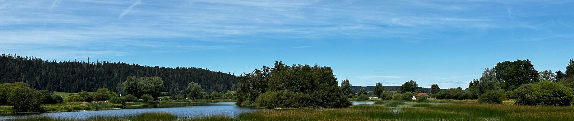
La réserve naturelle du lac de Remoray : le plan d’eau de la Seigne à Labergement-Sainte-Marie

Benjamin27
User GUIDE
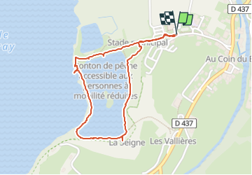

Length
2 km

Max alt
854 m

Uphill gradient
10 m
Km-Effort
2.1 km

Min alt
845 m

Downhill gradient
10 m
Boucle
Yes
Creation date :
2024-08-08 11:58:34.0
Updated on :
2024-08-11 18:29:35.183
28m
Difficulty : Easy

FREE GPS app for hiking
 SityTrail
IGN / Geographical institutes
SityTrail Plus
The world is yours!
About
Trail Walking of 2 km to be discovered at Bourgogne-Franche-Comté, Doubs, Labergement-Sainte-Marie. This trail is proposed by Benjamin27.
Photos

Positioning
Country:
France
Region :
Bourgogne-Franche-Comté
Department/Province :
Doubs
Municipality :
Labergement-Sainte-Marie
Location:
Unknown
Start:(Dec)
Start:(UTM)
292029 ; 5183384 (32T) N.
Comments