


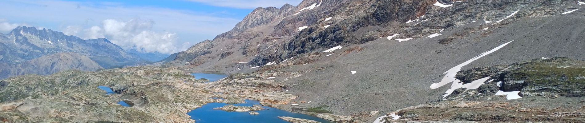
circuit des lacs, Blanc, du milieu, de la Fare, Balme rousse,dôme des Rousses

GEGERANDO17
User GUIDE
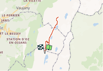

Length
9.8 km

Max alt
2806 m

Uphill gradient
341 m
Km-Effort
14.3 km

Min alt
2590 m

Downhill gradient
335 m
Boucle
Yes
Creation date :
2024-08-08 08:44:10.815
Updated on :
2024-08-08 13:58:34.98
3h36
Difficulty : Medium

FREE GPS app for hiking
 SityTrail
IGN / Geographical institutes
SityTrail Plus
The world is yours!
About
Trail Walking of 9.8 km to be discovered at Auvergne-Rhône-Alpes, Isère, Huez. This trail is proposed by GEGERANDO17.
Description
départ 2° tronçon Dmc Alpe d Huez
Photos


Positioning
Country:
France
Region :
Auvergne-Rhône-Alpes
Department/Province :
Isère
Municipality :
Huez
Location:
Unknown
Start:(Dec)
Start:(UTM)
272293 ; 5000164 (32T) N.
Comments