


Le Pic de Bernardez (Seyne 04)

Clo0413
User
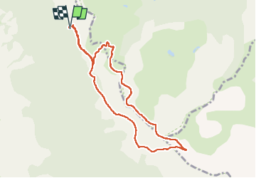

Length
9.4 km

Max alt
2417 m

Uphill gradient
557 m
Km-Effort
16.8 km

Min alt
1904 m

Downhill gradient
553 m
Boucle
Yes
Creation date :
2024-07-29 05:48:41.888
Updated on :
2024-08-09 14:25:05.543
3h00
Difficulty : Medium

FREE GPS app for hiking
 SityTrail
IGN / Geographical institutes
SityTrail Plus
The world is yours!
About
Trail Walking of 9.4 km to be discovered at Provence-Alpes-Côte d'Azur, Alpes-de-Haute-Provence, Seyne. This trail is proposed by Clo0413.
Positioning
Country:
France
Region :
Provence-Alpes-Côte d'Azur
Department/Province :
Alpes-de-Haute-Provence
Municipality :
Seyne
Location:
Unknown
Start:(Dec)
Start:(UTM)
292108 ; 4918021 (32T) N.
Comments