


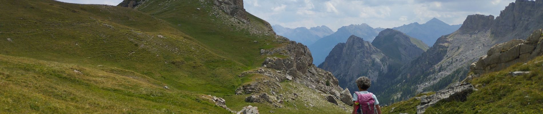
Cime de la Condamine en boucle

orsel
User GUIDE
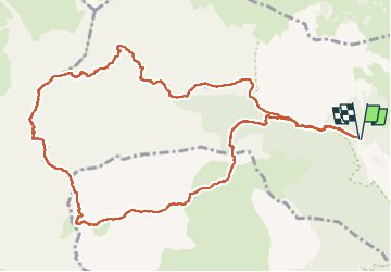

Length
13.3 km

Max alt
2937 m

Uphill gradient
1070 m
Km-Effort
28 km

Min alt
1869 m

Downhill gradient
1072 m
Boucle
Yes
Creation date :
2024-08-11 06:15:39.673
Updated on :
2024-08-11 16:19:33.697
6h01
Difficulty : Very difficult

FREE GPS app for hiking
 SityTrail
IGN / Geographical institutes
SityTrail Plus
The world is yours!
About
Trail Walking of 13.3 km to be discovered at Provence-Alpes-Côte d'Azur, Hautes-Alpes, Puy-Saint-André. This trail is proposed by orsel.
Photos


Positioning
Country:
France
Region :
Provence-Alpes-Côte d'Azur
Department/Province :
Hautes-Alpes
Municipality :
Puy-Saint-André
Location:
Unknown
Start:(Dec)
Start:(UTM)
308191 ; 4973886 (32T) N.
Comments