


Queyras sommet du Bûcher

c.gourme
User

Length
11.8 km

Max alt
2254 m

Uphill gradient
896 m
Km-Effort
23 km

Min alt
1468 m

Downhill gradient
597 m
Boucle
No
Creation date :
2024-08-12 06:20:45.0
Updated on :
2024-08-13 06:28:13.397

FREE GPS app for hiking
 SityTrail
IGN / Geographical institutes
SityTrail Plus
The world is yours!
About
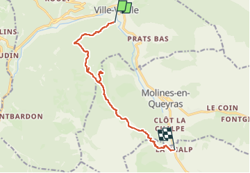
Trail of 11.8 km to be discovered at Provence-Alpes-Côte d'Azur, Hautes-Alpes, Château-Ville-Vieille. This trail is proposed by c.gourme.
Positioning
Country:
France
Region :
Provence-Alpes-Côte d'Azur
Department/Province :
Hautes-Alpes
Municipality :
Château-Ville-Vieille
Location:
Unknown
Start:(Dec)
Start:(UTM)
327447 ; 4958214 (32T) N.
Comments